Explore
Featured
Recent
Articles
Topics
Login
Upload
Featured
Recent
Articles
Topics
Login
Upload
Search Results for 'gis project'
gis project published presentations and documents on DocSlides.
GIS Data Management for
by funname
SHA’s . Bay Restoration Program. Jeff Tirschman,...
Nick Tonias, P.E. A Simplified Approach to Implementing GIS
by shangmaxi
1985. . The CEDRA Corporation is established. . ....
Cultivating GIS at the Brooklyn Botanic Garden
by yoshiko-marsland
Kyle Heulitt. Advisor: . Professor . Ken . Tammin...
GIS And Enterprise Architecture
by tatyana-admore
Presented by . John R. Woodard MS, GISP. A Quick ...
GIS at a Regional Level
by celsa-spraggs
Regional Planning & Development Councils and...
INTEGRATING SURVEYING AND GIS
by yoshiko-marsland
PREPARED FOR:. WVAGP SEMINAR. Jared D. Wilson. In...
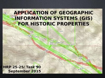
APPLICATION OF GEOGRAPHIC INFORMATION SYSTEMS (gis) FOR Historic properties
by teresa
NCHRP 25-25/ Task 90. September 2015. What is a GI...
Presented by: Craig Amey, PS
by pamella-moone
GEOG. 596:. Adviser: Dr. Frank Derby. A Python-B...
Welcome to
by ellena-manuel
Urban Geographic . Information systems. !. Dr. Ry...
City of Encinitas GIS Division Project Encinitas in a Nutshell
by conchita-marotz
City of Encinitas GIS Division Project Encinitas ...
GS6384 Vault is for More than Engineers: Integrating AutoCA
by luanne-stotts
Stephen Brockwell. President, Brockwell IT Consul...
Managing
by lindy-dunigan
. Where’s My Stuff. Why an enterprise-wide, . ...
Regulatory Compliance through GIS on a FERC-permitted Hydro
by faustina-dinatale
GIS that knows the difference between your ASM an...
Kurt Menke, GISP, Bird
by natalia-silvester
’. s Eye View. John Scott, Center for Public Se...
Spatial Data Management -The
by briana-ranney
St.Vincent. and the Grenadines Chapter. Author: ...
GIS Mapping of Indiana’s
by pamella-moone
Lake . Michigan Shoreline. Kaitlyn McClain. Coast...
GIS APPLICATION IN FIREWALL LOG VISUALIZATION
by tawny-fly
Penn State MGIS 596A Peer Review. Presenter: Juli...
The City of New Braunfels Parks and Recreation Asset Management Project
by calandra-battersby
The City of New Braunfels Parks and Recreation As...
The Nuts & Bolts of Enterprise Geographic Information Systems (EGIS):
by phoebe
A Success Story. The City of Oberlin’s EGIS Proj...
Understanding GIS: An ArcGIS Pro Project Workbook (Understanding GIS, 4)
by majestykodi
It’s no secret that this world we live in can be...
Katy Morris: Project Manager
by tatiana-dople
Nick Down: Assistant Manager. Travis Hamel: GIS A...
Using GIS to Make Project Data More Accessible to Employees of an Electrical Engineering Consulting
by danika-pritchard
Karen Rauschert. Advisor: Jim Detwiler. GEOG 596A...
1 REVIEW
by olivia-moreira
OF . RAPDRP PART A PROGRESS. IN KARNATAKA. Aug 2...
RTI Project Overview
by test
Frank Betz. Chief Operating Officer. Rahall Trans...
Coordinating Location Based Traffic
by kittie-lecroy
Count Data Collection Using . ArcGIS . Mobile App...
Two Tier Contracting Lean Improvement and ITPS Pilot
by myesha-ticknor
What is it?. When do we use it?. Scope of work va...
From the customer’s perspective
by karlyn-bohler
Contents. ePermits. Framework. Apply for an . eP...
FORCIP+ FOREST ROADS FOR CIVIL PROTECTION GA No. ECHO/SUB/2015/718661/PREP20
by zain242
PROTECTION. GA No. ECHO/SUB/2015/718661/PREP20. Pr...
Analyzing Inlets, Outfalls, and Land Cover Using Spatial and Network Analysis Within the San Antoni
by pasty-toler
Sewershed. Aspen Navarro, . Project Manager. , . ...
Transitioning
by celsa-spraggs
urban . resilience. . and. . sustainability. L...
Katy Morris: Project Manager
by karlyn-bohler
Nick Down: Assistant Manager. Travis Hamel: GIS A...
CSF Intern
by alida-meadow
Programme. :. H. onorary Interns. Sandra L. . Arl...
Hydrologic Application of Onion Creek
by alida-meadow
Revisit of the Halloween Flood from 2013. Juhn-Yu...
Using a Digital Terrain Model to Analyze a Watershed in Ord
by tawny-fly
Aspen Navarro, . Project Manager. , . GIS Analyst...
Shoreline, Biology, and Human-Use Data Collection and
by ellena-manuel
Integration. Research Planning, Inc.. Christine ....
MnTOPO – A place to view, print, and download LiDAR Eleva
by karlyn-bohler
Accessing and Viewing Minnesota LiDAR Data On-lin...
Designing a Spatial/GIS Project
by tatyana-admore
2/10/2017. Research Question. Does your question ...
Impact of Fluoride Concentrations on Natural Waters throughout Texas
by danika-pritchard
Mark . Stehouwer. GIS in Water Resources. Fall 20...
Shoreline, Biology, and Human-Use Data Collection and
by liane-varnes
Integration. Research Planning, Inc.. Christine ....
February 5, 2014 Downtown athletic club
by tatyana-admore
Eugene, Oregon. Welcome to the . Oregon . GIS . F...
Load More...